The Great Divide: The Extraordinary Paraguay Population Distribution
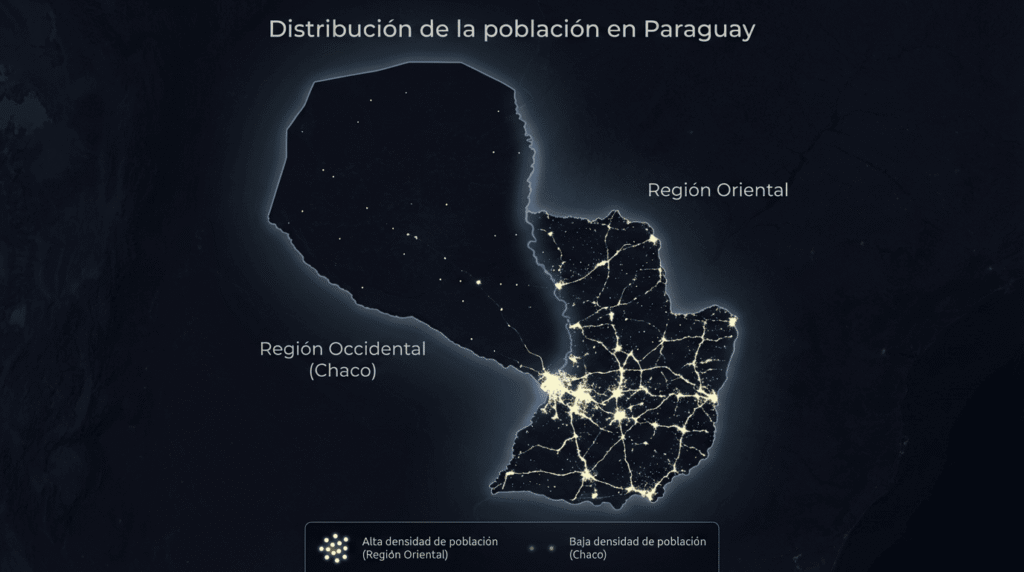
Paraguay holds a fascination for geographers and historians alike. You will quickly realize this landlocked nation is defined by startling contrasts. The Paraguay population distribution is perhaps the most unique feature you will encounter. It is a stunning demographic anomaly. A massive ninety-seven percent of the country’s total population lives clustered in just one-third of the national territory. This extraordinary imbalance is easily explained. It is the direct result of a powerful geographic and historical split. The central protagonist in this tale of two regions is the mighty Paraguay River.
This massive waterway divides the country longitudinally. The river creates two profoundly different regions. To the west lies the Región Occidental. This vast expanse is also known as the Paraguayan Chaco. It astonishingly accounts for 61% of the entire national territory. To the east is the Región Oriental. This smaller region is also called the Paraneña. It comprises the remaining 39% of the land. The concentration of people is simply staggering. Only 3% of all inhabitants live in the enormous Chaco region. Meanwhile, the Eastern Region is home to the remaining 97% of all Paraguayans. The sheer emptiness of the Chaco is undeniable. Its population density sits at a mere 0.86 inhabitants per square kilometer.
Paraguay population distribution: Understanding the Great Divide
Deep-rooted historical factors cause this extreme concentration of people. They are a mixture of geographical luck, historical decisions, and economic necessity. The contrast between East and West is stark. It dictated where life could flourish easily. It determined where colonization could be sustained. Today, it still defines the infrastructure and the economy. The Oriental Region acts like a massive magnet. It draws people with its ancient gifts of soil and water. The Western Region presents a relentless, harsh reality. It demands significant investment and struggle just to survive.
The Eastern Magnet: Why the Oriental Region Thrives
The Eastern Region, or the Paraneña, is often called the “Habited Third.” It offers immediate and powerful geographical advantages. These benefits were recognized centuries ago. The native Guaraní people first settled here. Later, the Spanish colonizers followed their lead.
The Oriental Region is blessed with fertile soils. It also enjoys a milder, more pleasant climate. The combination of rich soils and predictable rainfall made agriculture easy. This simplicity sustained both the original inhabitants and the colonists. Farming was productive and reliable here. This made long-term settlements highly viable.
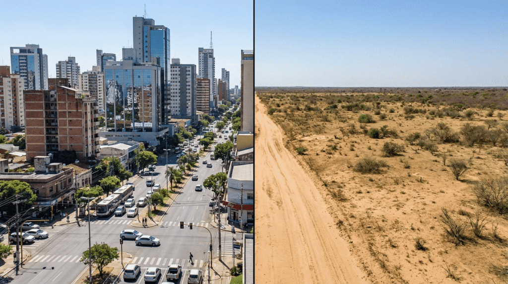
Above all, the abundance of freshwater is the greatest factor. The region is a vital hub for all of Paraguay’s hydrological resources. The water coverage in the East is virtually universal. This is due to its rich network of accessible underground deposits.
Consistent availability of fresh water
Most importantly, the great Guarani Aquifer underpins this entire region. This aquifer is one of the most vital freshwater reservoirs in all of Latin America. In the Eastern Region, the aquifer sits at a relatively shallow depth. This allows it to recharge easily and frequently with precipitation. The consistent availability of fresh water is a fundamental guarantee of life and economic activity.
This water abundance is the engine of the region’s economy. It has driven the significant development of the agro-industry. Large-scale cultivation of profitable crops happens here. Soybeans, corn, wheat, and sugarcane define the landscape. This industry requires vast support infrastructure and creates jobs. This further fuels the high Paraguay population distribution in the East.
The rivers in the Eastern Region
The rivers in the Eastern Region are also crucial for connectivity. They serve more than just fishing. They are highly navigable. This navigability allows for better movement of people and, more importantly, goods. It grants key connection to the Atlantic Ocean via the Río de la Plata system. This has always been essential for commerce. In fact, a majority of Paraguay’s largest municipalities are located right on these riverbanks. Ten of the eleven municipalities with over 100,000 inhabitants have a direct river connection.
Historically, the government prioritized this area for development. The capital city, Asunción, was founded in 1537 in this Eastern zone. Today, the Eastern Region contains the majority of all urban infrastructure. It hosts the country’s largest cities. The Eastern Region contains all the most prominent historical and cultural sites. It also concentrates the principal industries, commercial enterprises, and agricultural fields. Asunción alone concentrates close to 40% of the country’s entire population within its greater metropolitan area. The density of infrastructure begets more density.
The Western Wilderness: Confronting the Chaco’s Harsh Reality
The vast Región Occidental, or the Paraguayan Chaco, presents a wholly different set of challenges. Harsh geography defines this unique region. A more arid environment primarily characterizes this territory. Although the entire country experiences high temperatures, the intense heat in the West is far less manageable. The conditions can be truly unforgiving for permanent settlement.
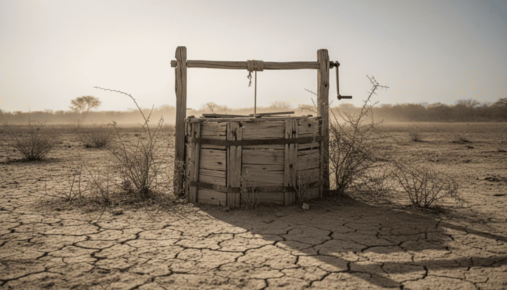
The crucial difference lies beneath the surface. Unlike the fertile and well-watered East, most of the underground reserves in the Chaco are saline. They are unusable for drinking or crop irrigation. Furthermore, the region receives scarce precipitation. This situation is worsened by recurring severe droughts. Many local communities, particularly indigenous settlements, must rely on the difficult process of rainwater harvesting. This lack of secure, fresh water has always acted as a fundamental barrier to mass settlement.
Economic activity in the Chaco
Economic activity in the Chaco remains limited. The region does earn revenue from livestock raising, ecotourism, and rural tourism. However, livestock farming is the only industry of significant scale. It requires very little human labor per square kilometer. There is simply no need for large population centers. This lack of job creation further explains the sparse settlement. People follow opportunity and security. Neither has been historically abundant in the Chaco.
Redrawing the Map: The Potential for Balanced Growth
The extreme Paraguay population distribution is a complex historical outcome. It is accentuated by the profound contrast in natural conditions. The East offered everything settlers needed: fertile ground, a comfortable climate, and guaranteed freshwater via the Guarani Aquifer and navigable rivers. The West offered aridity, harsh heat, and saline water reserves.
You should know that this stark geographic division is slowly beginning to change. The government and international partners are focusing on infrastructure projects in the Chaco. Projects like the Bioceánico Corridor are now physically connecting this isolated region. This new highway, linking Brazil and Argentina across Paraguay, passes directly through the Chaco. It promises to open up commerce and access. It could potentially shift the economic balance over the coming decades.
While the Chaco may never rival the density of the Oriental Region, its vastness represents untapped potential. Its wide-open spaces are ideal for large-scale, low-density activities like ranching. They are also crucial for environmental preservation. Paraguay is not simply an Eastern nation. It is a dual entity. Its future will depend on how successfully it can leverage the natural wealth of the East. It must also strategically develop the vast, challenging frontier of the West. This historical imbalance defines the country now. It also represents a major opportunity for pioneers looking to the future.
The Defining Feature of a Unique Nation
The massive disproportion in where Paraguayans live is the country’s defining geographic feature. It is a story of nature’s influence on human destiny. It reveals the wisdom of the early settlers who chose the fertile banks of the Paraná. Understanding this great divide is the first step. It helps you appreciate the true complexity and potential of life in this unique South American nation.

