Discover how the Paraguay water system drives the nation
Paraguay is a land where water is abundant. The strategic importance of Paraguay’s water system is clear to all. Its rivers form the foundation of national life. They do more than just transport merchandise. This water system defines the nation itself. The rivers mark borders with neighboring countries. They also divide the territory into two distinct regions. The Western Region is the vast Chaco. The Eastern Region is the most populated area. Water is a strategic resource here.
The Fluvial Pillars: Paraná and Paraguay
The two great rivers are essential. The Paraná River and the Paraguay River are vital. Both flow steadily toward the south. Both eventually empty into the Río de la Plata. The waters finally reach the Atlantic Ocean. They serve as major fluvial communication routes.
The Paraguay River originates in Matogrosso, Brazil. It borders the Great Pantanal wetlands. It crosses the very center of the country. The River flows directly to the capital, Asunción. It receives water from the Pilcomayo River. It then defines the border with Argentina. Its total length measures 2695 km. Over 2200 km of this is navigable. The section within Paraguayan territory is 542 km.
This river has a minimal gradient. It drops only 6 cm per kilometer. The water flows very slowly as a result. A journey from Brazil takes six months. Its navigability is crucial for commerce. The Port of Villeta is the country’s largest. Bolivia, another landlocked country, also utilizes it.
The Electric Giant: The Power of the Paraná
The Paraná River is the second major pillar. It begins in Brazil from two merging tributaries. It forms a natural border with Brazil. This occurs along a 190 km stretch. It reaches the famous Triple Frontier area. Argentina and Brazil converge there. The Iguazú Falls are nearby. Ciudad del Este sits at this point. The city forms a trinational metropolitan area. It is a city of over one million inhabitants. The flow of the Paraná is impressive. It moves 16000 m3 of water per second.
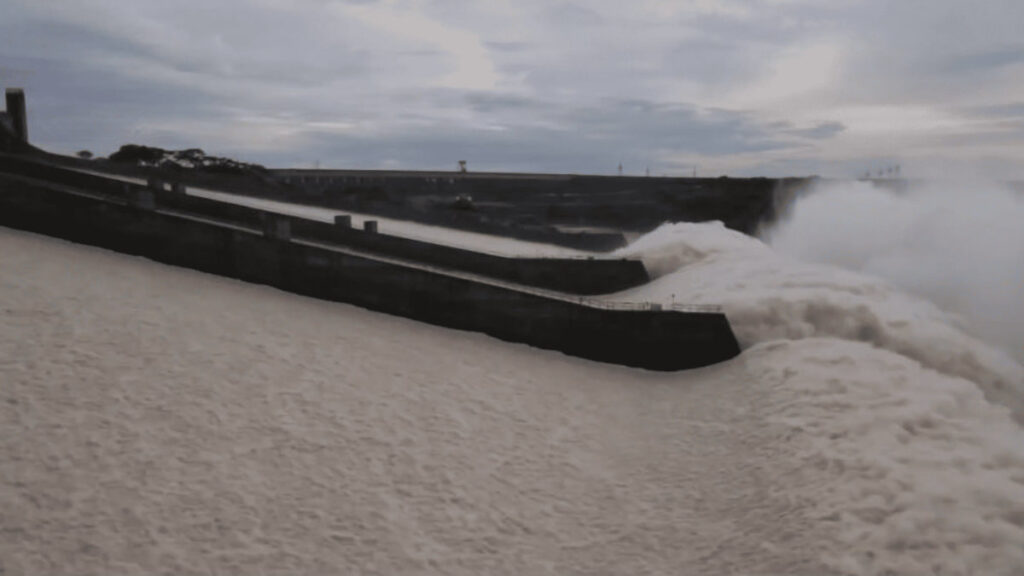
Its strong waterfalls are maximally exploited. Paraguay is a leader in hydroelectric power. It possesses two major binational dams.
- Yacyretá: It is situated on the Argentine border. Its Guaraní name means “place where the moon shines.” It has an installed capacity of 3200 MW. Its annual production reaches 20000 MW .
- Itaipú: This is the more important of the two. It is located near Foz do Iguaçu, Brazil. It was the world’s largest producer in $1984$. Its installed capacity is 14000 MW. It produces $90$ million {MW annually on average. It supplies 17%of Brazil’s consumption. It covers 72% of Paraguay’s energy needs. This production is a true national treasure
Subterranean Reserves: The Guaraní Aquifer System
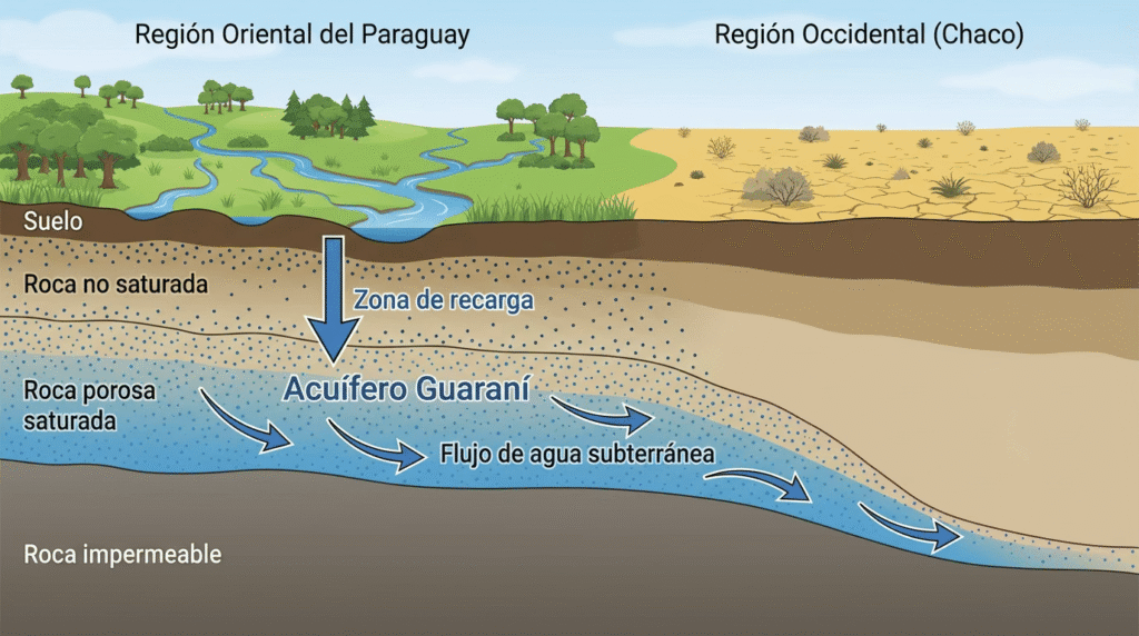
Paraguay is extremely rich in fresh groundwater. Aquifers are its subterranean reserves. The country counts three large systems.
The most critical is the Guaraní Aquifer. It is one of the largest on the planet. It extends across four South American countries. Paraguay has 72540 km of its area. Within Paraguayan territory, it is shallowest. It recharges easily with rainfall. This abundance is located in the Eastern Region. 97%of the population lives there.
Other important aquifers also exist. The Patiño Aquifer is in the east. The Irena Aquifer is located in the Chaco.
Challenges and Future of the National Water System
Though water abounds, contrasts exist. The Eastern Region enjoys universal coverage. Subterranean deposits are readily accessible. But the Western Region is very different. Reserves in the Chaco are mostly saltwater. Rainfall is the main source for many communities. Droughts are frequent and highly concerning.
Water is vital for the agribusiness sector. The Eastern Region uses it intensely. Large extensions cultivate soy and corn. This has caused high deforestation rates. Only one million forested hectares remain. There were over eight million in the last century. Poor agricultural practices degrade the soil. This risks the existence of fertile lands.
The Waterway and Environmental Pressure
Trade depends on navigable rivers. The Paraná-Paraguay Waterway is the key. It is a crucial fluvial engineering project. It covers 3442 km through five countries. The waterway allows navigation for shallow-draft vessels. It maintains the flow of crucial exports. Soy, beef, and fuel travel along it. The system requires continuous dredging. It eliminates meanders and sand islands.
But the waterway carries environmental impacts. Wetlands are rapidly disappearing. Water contamination is a serious issue. River biodiversity is being altered. Droughts threaten the fluvial economy. Paraguay faces enormous environmental challenges. It must protect its invaluable blue wealth.

